30 days in USA: day 24 – the South Point and Green sand beach

Looking for a morning coffee in Kona… Kona is a coffee town, isn’t it? But I couldn’t find my coffee there. Green Flash – yucky, Lava Java – watery. Seems I stop to drink any coffee with milk in Kona. Well damn, if its hot and has a coffee flavor, let it be. We are sitting in the center of Kona, having breakfast with a sea view with Ali Drive by one hand and the ocean by another.

I believe I start to understand why Americans shocked about European, especially Italian coffee. First thing might be, where is my coffee and what is that thimble about?  But trying that deep thick aroma you can’t stay indifferent. There are good coffee shops in USA also but mostly they look like an insider’s shops, garages or small rooms whereas you get such a good coffee even in a gas station in Italy. Food theme in USA is very strange to me and I have much more to say about it. Probably, I’ll get back to the theme later.

We drive to the South point and Green Sand beach today. Calm nice road is ahead. South Point is the southern point of the USA (really, its not Key West) and a national historic landmark.You can spot a wind farm close to the point.

I made a small video about the trip.

It does feel as the end of the Earth, even thou that wind you can feel a vitality of nature’s power.
_DSC5365-18Jul2015

By the way the point is one of Hawaii’s most popular and bountiful fishing place. You definitely meet a lot of fishermen.

_DSC5364-18Jul2015And cliff jumpers as well. I wish I could jump. But I didn’t. Continue reading

Day 23. Captain Cook trail. Honaunau park and coconut hunting.

This funny film where I am snorkeling and cracking whole coconut speaking Russian.

And the day 23 – trail to Captain Cook monument.

You have to be scared before the trail. Not all trails in Hawaii are like that but we chose challenging ones. It the trail is not as missed workout, it doesn’t worth doing. This one is short but good. Even to go downhill is challenging enough. My husband fall on the rocks and miraculously didn’t get crashed himself and the camera. After that he put in in the backpack and we don’t see any pictures from this trail until the very end.

IMG_9978

The only I have from my camera. 1/3 of the way is in high grass, which you can spot on the video above. Its disgusting enough, so you’d better wear long sleeve AND long shorts, which I didn’t have.

captaincookmap

Continue reading

Waipio Valley and Kona. Big Island. Day 22.

Ok, I was naive enough to think I would translate all my Hawaii and USA posts later but it had never happened. I even didn’t finished “USA month” yet. So from day 23 I decided to write it here directly.

Maybe not so huge posts but still something and of course a lot of pictures.

First of all I have short videos for each day, well, almost each day in Hawaii. And a lot, lots of pictures below.

This day we had to move from our jungle house in nowhere to Kona. This house was close enough to Waipio Valley, so we packed everything and went out to find it.

I read many warnings not to leave anything in a car while you are on a hike, so I was pretty nervous about that fact that we have all our stuff in the Jeep. On the parking close to Waipio was a booth with a guard, who was kind enough to promise to look after the Jeep. But still we packed our notebooks and camera and all passports backpack with us. Mine was ok, but my husband had on his back about 15 kg (28lb).

Of course, we knew that the road is steep but you know what we didn’t knew, it is the steepest road of its length in USA, for example.

The valley floor at sea level is almost 2,000 ft (610 m) below the surrounding terrain. A steep road leads down into the valley from a lookout point located on the top of the southern wall of the valley. The road gains 800 vertical feet (243.84 m) in 0.6 miles (0.9 km) at a 25% average grade, with steeper grades in sections. This is a paved public road but it is open only to 4 wheel drive vehicles. It is the steepest road of its length in the United States and possibly the world. The shore line in the valley is a black sand beach, popular with surfers. A few taro farms are located in the valley. Several large waterfalls fall into the valley to feed the river which flows from the foot of the largest falls at the back of the valley out to the ocean.

The warning sign which meets you at the start of the hike_DSC5147-15Jul2015And stunning view from the very beginning. I want to cry when I see this pics now in winter in Europe. Its freezing and gloomy and I wish to be there._DSC5207-16Jul2015Hiking lower_DSC5205-16Jul2015 Continue reading

Oahu. Part 1: Lanikai Beach, Pillbox trail, Waimanalo Park and Sandy Beach.

Let me skip first two days for one simple reason – we didn’t take our camera and relaxed with snorkeling and walking around. The third day my husband was totally sick with his throat and nose and fever so I had to tell “Good Bye” to my dreamy Olomana trail and turn to the beach.

The Lanikai beach was nice and very calm as recommended in Lonely Planet guide for families and snorkeling. But I wanted to have an adventure.

_DSC4238-08Jul2015-2

You can take a kayak to the islands in front of the beach or even swim there. I was afraid to swim alone but it didn’t seem too far.

_DSC4279-08Jul2015

Once I saw people climbing somewhere not far from the beach. And I said myself, if Olomana is not an option for us today, I can take this hike alone. My husband was bored and decided to join despite of his health condition. The trail named pillbox trail wasn’t very hard, but you need to have good shoes. It is muddy and many people fall.

Can be dangerous after heavy rain

_DSC4259-08Jul2015

Watch some people climbing on the picture below.

_DSC4309-08Jul2015

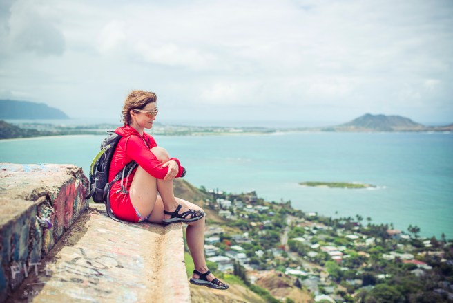
A piece of ridge and the view to Lanikai beach front_DSC4303-08Jul2015

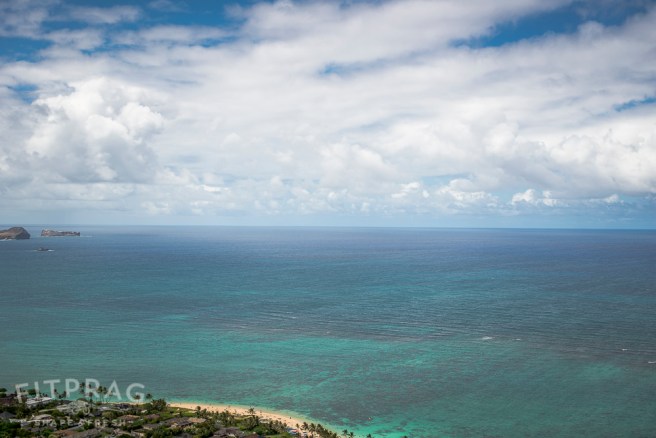
Lanikai beach and many many kilometers of water. Amazing!

_DSC4292-08Jul2015-2

The view from the other side of the ridge

_DSC4280-08Jul2015

Wonky stairs to the pillbox. Many people make pictures there.

_DSC4268-08Jul2015

And finally

_DSC4274-08Jul2015

Running down is an option. Maybe the one safety option.

_DSC4306-08Jul2015

Sandy beach is told as a beach for brave. And that is true. i wouldn’t ever enter even with a bodyboard.

_DSC4520-08Jul2015

There were a lot of rainbows there. Several tropical rains were passing by during that time.

_DSC4510-08Jul2015

My favorite picture

_DSC4429-08Jul2015

Selfie lovers. As you may guess they were washed in the water by waves. they were happy to get out quickly._DSC4391-08Jul2015-2

I would stay here forever

_DSC4383-08Jul2015

In the mirror

_DSC4369-08Jul2015

Trying to pose according to my beach mood board collection. It wasn’t as easy as it looked indeed.

_DSC4333-08Jul2015-2